


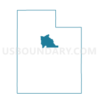
Provo 16 Voting District, Utah County, Utah
About
Outline

Summary
| Unique Area Identifier | 680300 |
| Name | Provo 16 Voting District |
| County | Utah County |
| State | Utah |
| Area (square miles) | 0.45 |
| Land Area (square miles) | 0.45 |
| Water Area (square miles) | 0.00 |
| % of Land Area | 100.00 |
| % of Water Area | 0.00 |
| Latitude of the Internal Point | 40.28465350 |
| Longtitude of the Internal Point | -111.64216180 |
Maps


Graphs
Select a template below for downloading or customizing gragh for Provo 16 Voting District, Utah County, Utah


Neighbors
Neighoring Voting District (by Name) Neighboring Voting District on the Map
- Provo 30 Voting District, Utah County, UT
- Provo 40 Voting District, Utah County, UT
- Provo 41 Voting District, Utah County, UT
- Provo 49 Voting District, Utah County, UT
- Provo Canyon Voting District, Utah County, UT
Top 10 Neighboring County Subdivision (by Population) Neighboring County Subdivision on the Map
- Provo-Orem CCD, Utah County, UT (200,995)
- American Fork-Pleasant Grove CCD, Utah County, UT (121,452)